It was a good trip to the Adirondacks this past Labor Day weekend. The weather was sweet. As usual I didn’t have the full three days I wanted to do the trails with. No matter, it was still a fun trip.
Saturday
Packing
Friday the 31st of August was a busy day as is typical for me at my job the last day of the month. I had wanted to leave early to prep for leaving early on Saturday. I left late that evening and instead chose to get a good night’s sleep. I spent the early part of Saturday packing what items I was going to take with me. On that note here is a list of the items I took on the trip to the White Mountains back in July along with the weight of each item:
- Backpack (Osprey) 4.25 lbs
- pack cover 0.25 lbs
- Sleeping bag (Kelty) 2.92 lbs
- Sleeping pad 1.43 lbs
- Tent (MSR) 4.20 lbs
- Tent poles 1.05 lbs
- Bear canister 2.90 lbs
- Katadyn Filter 1.23 lbs
- Jet Boil 1.47 lbs
- Jetpower fuel 0.44 lbs
- Rain gear 1.53 lbs
- tablet 1.68 lbs
- Nalgene bottles x 2 2.56 lbs
- hand shovel 1.17 lbs
- toiletries bag 0.92 lbs
- medical bag 0.75 lbs
- trekking poles 0.66 lbs
- head lamp 0.18 lbs
The total weight of these items is about 30 pounds.
For this trip I replaced the Osprey backpack with the Kelty Red Cloud at 6.2 lbs and I left out the tablet. The only other items not listed are clothing and food which can always vary.
New items for this trip
Kelty Red Cloud
The Kelty backpack was two pounds heavier than my Osprey, but has a more structured frame which is adjustable and I wanted to give it a trial run for this trip. It has a lumbar pad for the lower back. Also there is an adjustment for the position of the shoulder straps. Here is a link to Kelty’s website for a description of that pack http://www.kelty.com/p-411-red-cloud-110.aspx
Kühl Revel 1/4 Zip
I ended up wearing this for the night hike I did after arriving at the Adirondack LOJ. Very comfortable, kept the cold off me yet did not get too warm regardless the work of hiking. http://www.kuhl.com/products/3007/
EMS Men’s Divergence Fleece Jacket
Mostly used this for when I was at camp. Had it been later in the season or had I gone up to any windy summits I might have worn this while hiking. EMS Fleece Jacket
The Drive
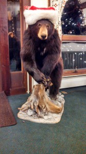
I left the apartment shortly after two in the afternoon. Topped off at the local gas station and didn’t stopped until I hit Crossroads Outdoors country store off 87 north at exit 25 in Chestertown, NY, http://www.crossroadsoutdoors.com. Very nice souvenir shop with lots of black bear themed items. I topped off on gas here and had a sandwich at the deli. They also have some items for fishing and camping.
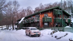
Arrival
I arrived at the High Peaks Information Center (HPIC) parking lot around seven o’clock in the evening. There is a booth before the parking area, but no one was present. Envelopes are available for after hours to pay for parking. I paid $25 dollars, part for what was left of my Saturday and all of Sunday and Monday. Adirondack Mountain Club (ADK) members pay half price. There were plenty of cars and people around the Programs Center building. They were having a presentation on the bears in the Adirondacks region so I hung around to have a listen. After the program I talked with someone at the information booth about camping in the immediate vicinity. He said they were full and sleeping in vehicles was not allowed. Maybe I should have called ahead this being Labor Day weekend and all -.-
Night hiking
Being as there was no camping spaces available in the Heart Lake area I decided to try my hand at night hiking. I actually read about another individual that got up at around 2 am just to summit Mount Marcy early to see the sun rise and took care of a few other peaks early in the day. So I had no qualms about giving it a shot. I put on my headlamp and off we went. It was 10:30 and so I was planning to hike until around probably 12 midnight. The registration and information kiosk was at the southeast end of the parking lot across from the HPIC. I get on the Van Hoevenburg trail headed southwest to Marcy Dam. I did run into some hikers on their way back to Heart lake.
Arriving at Marcy Dam it was a bit confusing as there was a trail that appeared to head off west from my direction and the bridge across the dam was out. I remember from looking at my map previously that I wanted to head off in an easterly direction. Just off the trail north of where I stood on the dam was a sign denoting a trail. Taking this route I found a foot bridge going across. I go back south toward the dam, east a couple of paces and find another trail heading southerly after passing another registry and information kiosk on this side. I proceeded south along (Marcy Brook trail?). There were supposed to be three lean-tos along the trail here. I found a campsite tag on my left as soon as I started this trail. It should be tagged on my map here. I considered setting up camp and taking a break until the following morning. Knowing, according to my map, there were lean-tos to my right further down I decided to move on and find one of those. Better to just pop out my sleeping bag and crash this late then to pull out the tent and set everything up. I never did find the lean-tos. You miss a lot of things traveling in the dark with just a head lamp to keep the trail lit. I have to decide if I am going back to the campsite I found just after Marcy Dam or proceed ahead down Avalanche Pass toward Avalanche Lake. I press on ahead.
As I make my way through Avalanche Pass the trail narrows, actually not the trail, but the area between the two ridges. Avalanche Mountain to my right and the ridge going up to Mount Colden to my left. This area is where I believe I found many trees that appeared to be uprooted. As if giants had walked through here, pulled them up and just left them there. It was unnerving for me as I was barely able to tell what was trail and not. Daylight is one thing. Being in the dark like this is something totally different. I kept looking to what sky I could see through the dense underbrush here. Thank god there was a full moon on this weekend. Bad enough I have a thing for being in enclosed spaces. Ironic when I think about it. The great outdoors, but the darkness, further exacerbated by the ridges on both sides, continued to make me uneasy. The boundaries of my confinement is defined by the area lit by my headlamp. I trudge on further into the bowels of the unknown.
I finally make it to Avalanche Lake and am very happy seeing open space. Five hundred foot cliffs span both sides of the lake, but there is plenty of sky in between. With the moon out I can just make out the cliff across the lake. The lake is eerily dark and appears to absorb all light like the event horizon of a black hole. As I think of this now, I imagine it is due to the reflection of the cliff on the water. Sadly I did not bring a regular camera with me and only had my cell phone. I found out very quickly that it did not perform at all in all this darkness. I was able to take and bring out this one pic of a bridge that skirts the cliff on the side of the lake I was on. The trek through this area is what I would say, difficult, yet amazingly I was able to do it. There were plenty of big boulders and log ladders and bridges were made to make traversing this section of trail (if you wanted to call it a trail) possible. It was around two in the morning. I of course was tired, but unless I were a spider and could make my way up these walls, there was no place in this lake area to set up any kind of camp. I continue to move on. I know at the south end of the lake there may be a possibility of crossing over to the eastern side of Lake Colden and a chance to get away from what I would say is basic training all over again.
I do get over to east side of the next lake and find it is easier but it isn’t until around five in the morning and on the southern part of Lake Colden that I finally find a campsite up on the left. I make camp and it isn’t long before I am forever lost to the world, well… for the next several hours at least.
Sunday
Late start
I got up late this morning. Hell, it was noon. I get out of my tent and prepare to get things packed. Couple of boys show up at camp looking for the trail to Mount Colden. They mistook the trail to my camp for the one to the Colden summit. That was north of here, the direction I came from, early this morning. This brings me to an android app I’d like to introduce if you’re in the market for one. These hikers had a map app on their iPhone they were using to help them see where they were at. Problem was, same as in the White Mountains, there was no reception here. I have an app called ViewRanger that allows me to pre-cache maps on my android device. They also make a version for the iPhone. Unfortunately I forgot to download a detailed map of this area on my phone. It would have saved me possibly an hour’s time on my way to the Feldspar campsite this very same evening. I break camp at around 2:30 pm, stop at the lake to top off on water, then head south and east toward Calamity Brook Trail.
Ranger’s station
At some point before the bridge that crosses the Opalescent River I hit a crossroads with one leg that pointed in the direction of the ranger’s station. It was here I was seriously considering dropping off my backpack and heading directly back to the parking lot. Since I got up this morning I had been thinking about what it would take to get back to the vehicle. The previous evening’s trek had taken a lot out of me and it was affecting my disposition in a bad way. I talked myself into continuing.
Getting across the Opalescent River by bridge I made a right based on how I read the sign on the other side. There are several places here good for setting up camp and they were occupied. I made note of this place for future trips. I go back the way I just came, realizing that I turned the wrong way at the bridge. I asked a small group of hikers about the direction I was headed in / they had come from to see if I was going right way. They did not know the trail that we were on nor could confirm whether the Uphill lean-to was ahead or not. I decided to rely on my map and compass.
Feldspar camp
I finally get to the crossroads that turns off east to Mt. Marcy. Just past this spot, to the north, is the Feldspar lean-on the left. I find a solo campsite off to the right and start setting up. It is around 6:00 pm. I get the tent up, make my way to the river to fetch water. I had bought an MSR bladder that holds six liters of water for my last trip. I did not use it then, but I do now. I take it to the river to fill and hang it off of a tree. It holds more than enough water for supper, clean up, and to refill the bottles in the morning. Speaking of supper I had sweet and sour chicken with rice. Surprisingly this was very good. This was Backpacker’s Pantry. I also eat from Mountain House.
Monday
10:00 am start
Waking up the following morning I find the underside of my tent fly is damp. I thought perhaps it had rained the night before or there was dew outside. I checked and everything was dry outside the tent. I came to realize the moisture was from my exhalation, the fly being closed, and the mountain air cooling down overnight. I could have left a couple of openings at two ends of the tent to allow for air circulation thus allowing moisture to escape.
Hike up to Lake Alvin
Met up with a couple at the river before the trek up. We talked about pack loads (obviously my backpack appears large) and they showed me the UV water purifier they were using to kill parasites in the water. Something I have considered. I just can’t get past the part of not filtering the water. They let me know the hike to lake Alvin is uphill from here. The first part of this leg of the trip is pretty level and about halfway up the trail starts to climb. Being well rested from last night this is not an issue.
Lake Alvin
Lake Alvin is the highest point of my hike. Approximately 3800 feet and close to the tree line. I met with a man hiking with his two kids. Supposedly Mount Colden would be one of the last couple of peaks he would have to do to complete the 4000 footers in the Adirondacks, trail and trail-less. This can be found on page 217 of Lisa Densmore’s book, “Hiking the Adirondacks”. One of two books I purchased, available for download on Google Play if you have an android device. I’ve saved them locally on my phone and tablet so I can access them wherever I am when backpacking. He was very helpful in giving me information for my next trip. He said I could set up camp at a spot for a number of days. Take a small hip pack to summit several peaks. Honestly, setting up camp and leaving my stuff there is a concept foreign to me as I grew up in the city. I have considered and had mentioned in my White Mountains blog entry just taking a small pack to summit. I had done this in El Yunque back in May of this year (that entry does not exist as that was before this blog, but I may post those pictures as that was the catalyst that got me to researching and finally buying equipment for these trips).
He also gave me an alternate route I could use to get to Lake Colden via Henderson Lake since I will always be coming from the south when I travel here. I just did a distance vs. time check for the drive to both lakes. The Henderson Lake drive is a shorter distance, but goes through more of the back country so the time comes to about the same. I may choose to avoid this route in more inclement weather.
Pretty much downhill from here
After Lake Alvin everything was downhill from here. The trek appears pretty long. That of course is a matter of perspective. I make it back to the crossroads that turns off to Avalanche Pass. The trail here to Heart Lake I had not seen in daylight and so it was all new to me still. Heading north to Marcy Dam I find one of the lean-tos I missed that first night out. Further north I make it to the dam. The lake I expected to see was not there. I suppose the lack of rain this season has had its effect. I finally arrive at Heart Lake around three in the afternoon.
The Drive back
I decide to go to Keene driving back as I had seen a number of eateries on my way here. The drive there takes me back by the Cascade Lakes. The beautiful lakes lay just off the side of a cliff that is part of the Cascade Range. Reminders of Avalanche Lake.
At Keene I go to the ADK cafe, http://www.theadkcafe.com. It is not crowded which is kind of nice. Probably because it is a Monday evening and Labor Day. First thing I noticed as soon as I walk in is the smell of fresh bread baking. I order the sausage and rice soup, The Dartbrook Club sandwich in which they use free-range chickens, this is new, and the cowboy beans (spicy). What amazed me here was the sandwich. I was surprised how tender it was. The sandwich was not dry, the chicken was moist. It reminded me of one other time at a deli on East Houston St. in New York City, but that’s another story.
Despite the possible setbacks considering how things started on this trip, I leave here feeling more accomplished and experienced. No summit on this trip, but that much closer to making it so. My goals for next year? To do a number of peaks and also to plan a major trip somewhere such as Yosemite or Yellowstone. I’ll keep you posted.